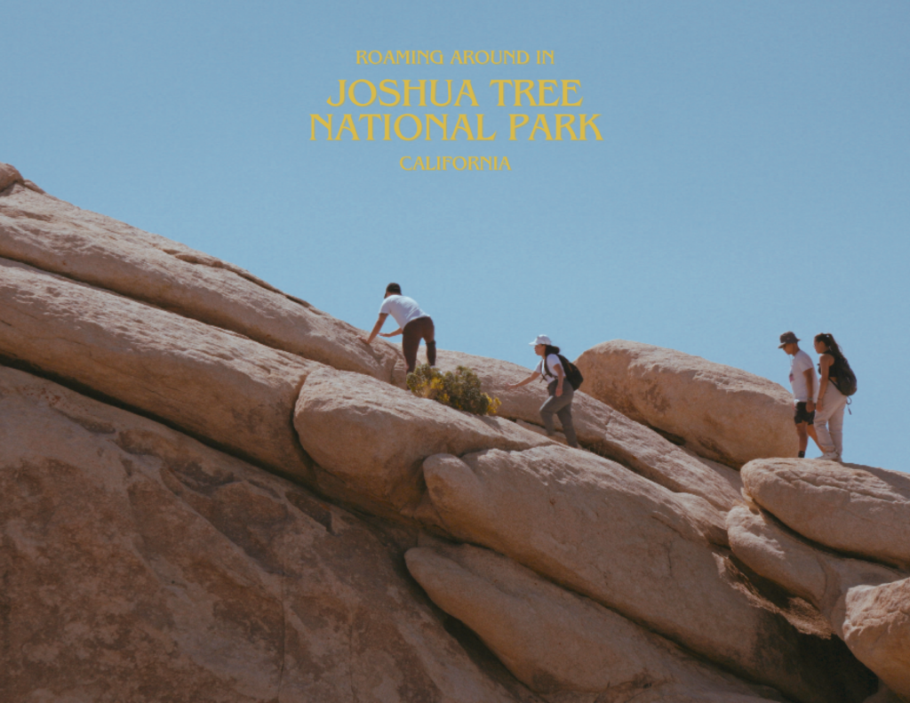
10-DAY ICELAND RING ROAD GUIDE & ITINERARY
ICELAND
The Land of Ice and Fire. A place where the magic never seems to stop. From the radiant midnight sun to somber polar nights, Iceland will deliver a sense of liberation and endless wonder.
This is our 10-day journey around the Ring Road.
Being from Canada, you would think going to a warmer destination would be much more appealing than a place called Iceland, where it’s just as frigid. Yet, there is an aspect to Iceland that is certainly enchanting. The dramatic and diverse landscapes of the Land of Ice and Fire are truly remarkable sights to see.
Iceland has it all. Boundless sheets of blue ice glaciers, a myriad of thunderous waterfalls, towering volcanoes that scorch the land, finished off with brilliantly coloured mountains.
For us the Ring Road is the epitome of an epic expedition. From navigating through desolate lava fields to driving over wild river crossings. Cruising across the barren highlands and up into the frosty tundra, it is surely an unforgettable adventure.
In this guide, we’ve included information about what to do, where and when to go, how to get there, and some tips on how to save some money.
WHEN IS THE BEST TIME FOR THE RING ROAD
To fully grasp the beauty of Iceland, the most ideal time for a trip around the Ring Road would be during late spring into the summer, when the F-roads are entirely accessible to travellers with a 4×4 vehicle. Icelandic highlands are incredibly stunning and definitely worth the time to explore these amazing landscapes.
By visiting in the summer, you forego the possibility of touring the ice caves and the spectacle of the Northern Lights, but in return, gain the opportunity to experience the phenomenon of the midnight sun and greet the Atlantic puffins.
Amidst the winter, sections of this route may become impassible due to extreme weather conditions, and F-roads are closed, denying passage into the highlands.
We visited in October, the shoulder season, and while we were only graced by the sun once throughout our trip, we had the privilege of living out some memorable moments.
ICELAND ROAD TRIP OVERVIEW
Day 1: Golden Circle
Day 2: Landmannalaugar
Day 3: Southern Iceland
Day 4: Vatnajökull
Day 5: Stokksness & Eastfjords
Day 6: Stuðlagil & Mývatn
Day 7: Diamond Circle
Day 8: Akureyri
Day 9: Fagradalsfjall
Day 10: Reykjavík
RING ROAD MAP
DAY 1 - GOLDEN CIRCLE
The Golden Circle is Iceland’s most famous scenic route within the Ring Road, and is just the beginning of what Iceland has to offer.
Fly into Keflavík International Airport (KEF) and pick up your rental car. Start the journey by driving towards the Golden Circle. During this 3 hour and 30 minute drive, here are some popular spots to stop for:
- Þingvellir National Park – a historic site situated in a rift between two tectonic plates with fissures and rocky cliffs.
- Geysir & Strokkur – geothermal geysers in the Haukadalur Valley that erupt within every 10 minutes up to 40 meters high!
- Gullfoss – the ‘Golden Falls’, one of Iceland’s more iconic waterfalls, located in the Hvítá river towards the end of the Golden Circle.
SNORKELING IN SILFRA
Silfra is a fissure formed between the North American and Eurasian tectonic plates within the Þingvellir National Park, and the only location on Earth where swimming between tectonic plates is possible.
There are many great tours for this excursion, and Viator has many options available to book online.
Reykjadalur Valley
Finish the day with a hike to the Reykjadalur Thermal River. It will be a 45 – 60 minute hike one way, but you will be rewarded with a soothing, warm bath in a natural hot spring accompanied by spectacular views of the Steam Valley.


Travel: 3 hours and 33 minutes (246 kilometers) | Stay: Þingskálar Country Cottage, Hella
DAY 2 - LANDMANNALAUGAR & SECRET LAGOON
Today, you will venture off the Ring Road and into the Icelandic highlands and one of the best areas for astounding scenery, Landmannalaugar.
There are three routes that lead into Landmannalaugar:
- F208 North – coming from the north, the easier but longer and much less scenic path into the highlands, with no river crossings.
- F225 – coming in from the west, F225 is shorter but more rugged with a couple small river crossings. This F-road is considered a shortcut, yet still provides extraordinary views.
- F208 South – the longest and the most beautiful of the three. This route involves several river crossings that are doable for travellers with minimal experience driving through water.
If you are staying near Hella or Reykjavík, F208 North or F225 would be your most optimal choice, and F208 South, if your stay is in Vík.


SECRET LAGOON
Finish off the day by taking F225 towards the town of Flúðir and unwind at the Secret Lagoon; Iceland’s oldest geothermal pool. It is charmingly cozy and blissfully relaxing.


Travel: 4 hours and 14 minutes (249 kilometers) | Stay: Þingskálar Country Cottage, Hella
DAY 3 - SOUTHERN ICELAND
If we had to choose a day as the defining period throughout the course of our trip, this was it. The Southern part of Iceland is undoubtedly an attractions galore, with 5 significant landmarks and the coastal town of Vík.
SELJALANDSFOSS & GLJÚFRABÚI
For day 3, enjoy a delicious morning coffee and begin by driving south on Route 1.
The first stop will be at Seljalandsfoss, right off the Ring Road. Found on the South Coast, this 200-foot waterfall allows sightseers to completely encircle it. One thing to note, since it faces west, avid sunset chasers can delay this stop until dusk if they aren’t staying too far.
Next, march just a tad north to encounter Gljúfrabúi. Hidden behind a tiny slot canyon, you will discover a 131-foot waterfall cascading down a mossy enclosure of rock into a small reservoir. This is truly what you’d call a hidden gem. Prepare to be utterly soaked!


SKÓGAFOSS
One of the largest and most distinctive waterfalls in Iceland. Although being an astounding 82-feet wide, the magnificence lies above Skógafoss.
Climbing up the Skógafoss stairs, and a short hike up the Fimmvörðuháls trail, you will discover at least 8 other waterfalls that ultimately flow into Skógafoss.


SÓLHEIMASANDUR PLANE WRECKAGE
Heading about 10 kilometers east from Skógafoss on Route 1, you will find the entrance to the downed DC-3 plane at Sólheimasandur.
From the parking lot, the wreckage is approximately 3.5 kilometers towards the southern coast (50-minute to an hour walk) if your choice is to get extra steps in. If you are in good physical condition, we would recommend this option.
Helpful Tip: the sign says 3 – 4 hours round trip, but we truly believe anyone in decent shape could get there within an hour.
There is a shuttle bus available costing around $20 USD, that can be reserved ahead of time or on-site. It takes 15 minutes each way and operates in 35-minute intervals.


DYRHÓLAEY
Translated to “the hill island with the door hole”, you are granted with absolutely staggering scenes of the southernmost part of Iceland.
With a brief walk from the parking lot, the Dyrhólaey Peninsula features a notable historic lighthouse, an endless black sand beach, and the appallingly traversable famed arch in the peninsula.


REYNISFJARA BEACH
Conclude the day with a final drive to the alluring Reynisfjara Beach, where you are met with riveting rock formations, menacing ocean waves, and the lofty basalt columns, Reynisdrangar.
Located at the foot of Reynisfjall, it is home to native seabirds; the Atlantic Puffins, and can be spotted throughout summer.
We were fortunate enough to arrive during the perfect conditions, setting an ominous mood to complement the treacherous nature of this beach.


VÍK Í Mýrdal
Vík is a marvelous coastal town on the Southern coast with several things to do:
- Reyniskirkja – a wooden church to the west of the town that dates back to 1929.
- Vík Í Mýrdal Church – a church to the northeast overlooking the bulk of the village.
- Icelandic Lava Show – the first and only live lava show in the world that recreates a volcanic eruption.
- Víkufjara Beach – a black sand beach on the south section of Vík.

Travel: 3 hours and 27 minutes (250 kilometers) | Stay: Holiday House 1, Kirkjubæjarklaustur
DAY 4 - VATNAJÖKULL & SKAFTAFELL
On day 4, you’ll be exploring the vast glacier at Vatnajökull National Park. Before that, start the morning with a peaceful stroll atop the Fjaðrárgljúfur Canyon. The observation desk presents a terrific view of the deep and winding canyon.
VATNAJÖKULL NATIONAL PARK
One of Iceland’s three national parks and the second-largest in Europe, with a range of outdoor activities and attractions. There are countless options, but we recommend prioritizing these.
Vatnajökull Glacier
Iceland’s and Europe’s largest glacier, spanning 8,100 square kilometers. Among craggy volcanic layers veiled with strikingly crystal blue ice, it is one of the country’s most superb and intimidating sights.
A tour of the ice caves won’t be available in the summer, but definitely consider booking a glacier hike as these excursions are open year round.


Skaftafell
A nature reserve within the Vatnajökull National Park, reclassified as a national park, and features two gigantic glaciers, Skaftafellsjökull and Svínafellsjökull.
A lengthy 45-minute hike will have you directly in sight of one of Iceland’s most astonishing waterfalls, Svartifoss.


Jökulsárlón Lagoon
End the day by observing rogue icebergs at the majestic Jökulsárlón Lagoon. These enormous icebergs will continue to flow south out of the Jökulsá river and into the Atlantic Ocean.
Follow the remote glaciers to the southside of the Ring Road, and you will locate the magical Diamond Beach, littered with giant ice cubes.


Travel: 3 hours and 3 minutes (224 kilometers) | Stay: Höfn
DAY 5 - STOKKSNESS & EASTFJORDS
Begin the morning of day 5 at Stokksness and capture shots of the almighty Vestrahorn mountain. Spend some time at the Viking Cafe for a quick breakfast or wander the charming Viking village for a small fee.
If that is not your cup of tea, drift down to the shore of the peninsula and watch as the waves relentless crash into the rocky coastline.


Eastfjords
Continue the journey by driving up the eastern coast on Route 1. Tonight’s stay is about 3 – 4 hours away in Egilsstaðir.
On this drive, take the opportunity to admire to the small and delightful towns of Djúpivogur and Breiðdalsvík as you weave through the Eastfjords. If it is open, trim your drive by traveling inland on Route 95 upon passing Breiðdalsvík.
If time permits, Seyðisfjörður is a 30-minute (one way) detour from Egilsstaðir, with vibrant colours and incredible views of it’s fjord.


Travel: 3 hour and 45 minutes (265 kilometers) | Stay: Axis-Buttaðir 4, Egilsstaðir
DAY 6 - STUÐLAGIL & Mývatn
STUÐLAGIL CANYON
Leaving from Egilsstaðir, head west on the Ring Road to arrive at Stuðlagil, where you’ll find Iceland’s most formidable collection of basalt columns. Situated along the Jökulsa á Brú, there are two ways to explore this natural wonder.
VIEWPOINTS OF STUÐLAGIL
Separated by the Jökulsa á Brú river, there are two main viewpoints, the west bank and the east bank.
- West Bank – from the Ring Road, make a left onto Jökuldasvegur (Route 923), and keep left at the fork. Proceed for about 20 kilometers to reach the metal stairs overhanging the canyon.
- East Bank – following the Jökuldasvegur road, and turn left at a sign for Klaustrusel. You have the option to park at Stuðlagil (east side parking) (1-hour hike) or cross the bridge and continue down a bumpy road for 2 kilometers to Parking Klaustrusel (30-minute hike).
The west side is deserving of a stop, and much easier to reach, however, it grants no access to the east bank and the views are not nearly as good.
Despite the added effort, we definitely recommend going to the east bank; the only way to feel it’s full grandeur.


MýVATN
A lake in the northern part of Iceland filled with natural richness. Known for it’s lively volcanic and biological activity, here are some things to do.
Helpful Tip: there is an abundance of sulfur due to the nature of Iceland causing certain areas to smell like rotten eggs. This is one of them.
NÁMAFJALL
Also known as Hverir; is a geothermal area at the foothills of Mt. Námafjall, decorated with vivid sulfur crystals. Scarred by fumaroles and boiling mud pools, this region is immensely fascinating.
GRJÓTAGJÁ
Tucked away underneath a rift, this ancient lava cave contains a geothermal spring, and served as one of the many filming locations of HBO’s Game of Thrones.
Mývatn Nature Baths
An exceedingly popular hot spring on the northern side of Iceland. This mineral-rich lagoon, dyed beautifully in turquoise, serves as the perfect way to conclude the night and rejuvenate for the remainder of the trip.


Travel: 4 hours and 22 minutes (309 kilometers) | Stay: Sílastaðir 2, Akureyri
DAY 7 - DETTIFOSS, HUSAVÍK & GOÐAFOSS
Moving away from civilization, Northern Iceland will be much more desolate than what you’ve been accustomed to. On day 7, leave early in the morning from Akureyri for an intense and long day of exploration around the Diamond Circle; North Iceland’s most popular route consisting of 4 major stops.
DETTIFOSS
Regarded as the most powerful waterfall in Europe, Dettifoss is the pinnacle of unfathomable strength. Similar to Stuðlagil, there are two ways to see this enigmatic wonder.
- Dettifoss West Side – from the Ring Road, turn onto Route 862 and drive 24 kilometers north to arrive at the Dettifoss Parking West. Another quick 12-minute hike will give you panoramic views of the 44-meter drop.
- Dettifoss East Side – from the Route 1, turn onto the old and rugged Hólsfjallavegur (Route 864) and continue north for about 30 kilometers until you reach the Dettifoss Parking East. Parade down the stony steps for a misty spectacle.
For the landscape enthusiasts, we’d suggest the west side as it offers a wider perspective. For the brave and adventurous, the east side enables the courageous individuals to stand inches from the crest of the falls.
Helpful Tip: the rocks above the falls can become slippery due to the mist from the falls. If you decide to approach the falls, proceed with extreme caution.


ÁSBYRGI CANYON
A horseshoe-shaped glacial canyon covering 14.8 square kilometers that is believed to have formed over the last ice age. There are several hiking trails ranging from easy to difficult:
- Botnstjörn Pond Trail – a 1.3-kilometer loop in the canyon that features the Botnstjörn Lake.
- Klappir Trail – a 9-kilometer out-and-back trail along the canyon edge with impressive vistas of the canyon below.
- Kvíar Circle – a challenging 17-kilometer loop around Ásbyrgi that displays lush vegetation and outstanding foliage.


HUSAVÍK
A peaceful town on the North coast of Iceland along Route 85, Husavík is the country’s oldest settlement. Renowned as the “Whale Capital”, this will be the best time for a traditional whale watching tour as sightings are almost guaranteed in the summer months.
If time is limited, rest here and recharge with lunch in one of the many restaurants before your departure.
GOÐAFOSS
Labeled the “Waterfall of the Gods”, Goðafoss undeniably possesses a mysterious and graceful aura. Flushed with a captivating shade of cerulean, it is a serious contender for Iceland’s most beautiful waterfall.
Goðafoss is one of the easier waterfalls to access, as it sits on the Ring Road. Whether you’re observing from the west bank or east bank, this is a waterfall you can’t afford to miss.


Travel: 6 hours (454 kilometers) | Stay: Sílastaðir 2, Akureyri
DAY 8 - AKUREYRI TO STÓRA-VATNSHORN
Today, double back to Goðafoss if you didn’t get a chance to see it yesterday, before continuing west.
FOSSLAUG
Take a calming afternoon soak at Fosslaug; a natural hot spring nestled in next to the Húseyjarkvísl river. It is completely free and supplemented with a breathtaking backdrop of the distant mountains.
For an true authentic Nordic experience, awaken your spirit with a cold plunge in the Húseyjarkvísl river!
Down the stream, you will find Reykjafoss, a pretty but easily forgotten waterfall. Two of Iceland’s best hidden treasures.
HOW TO GET TO FOSSLAUG
- From Route 1 turn on Route 752 (Skagafjarðarvegur).
- Follow Route 752 southbound for 4.9 kilometers.
- From there, turn onto Route 753 (Vindheimavegur). It’ll be the first left turn from Route 752.
- Continue for 0.8 kilometers and turn right onto the gravel road, Vindheimamelar.
- Keep driving until you reach the Reykjafoss Car Park.
It’ll be about a 15-minute hike from the parking lot. Once you have located Reykjafoss, follow the river upstream for around 40 meters and you will spot Fosslaug.


Blönduós is the final town along the Ring Road on tonight’s drive and an excellent place to stop for dinner before settling in for the night. Otherwise, head home early and enjoy the night with a homey meal.
Travel: 3 hours 37 minutes (287 kilometers) | Stay: near Stóra-Vatnshorn
DAY 9 - FAGRADALSFJALL
From Stóra-Vatnshorn, Fagradalsfjall is a 2 hour and 40 minute drive. If you feel the need to stretch your legs, there are a couple stops along the way: Grábrók; a colossal volcanic crater to the north of Bifröst, and the enormous abandoned cavern, Surtshellir.
SURTSHELLIR
A one-mile long lava cave in the Hallmundarhraun lava field. Named after the Norse fire giant Surtr, this beast is an unbelievable sight. With 10-meter high basalt roofs and vitrified magma walls stretching up to 15 meters wide, it is an exhilarating adventure for the souls who dare to approach.
Some important details to address:
- Headlamps or flashlights and hiking boots are essential, do not attempt without them.
- This area is particularly desolate, and will be self-guided, so remain vigilant and cautious.
- A 4×4 is recommended as F578 is the only road that provides access to Surtshellir.
- Be wary of the weather conditions as Iceland is known for its erratic climate.
This is a 55-minute detour (one way) from the main route, but it is entirely free. If you prefer a guided tour, The Cave Víðgelmir is a paid expedition into Iceland’s largest lava tube.


FAGRADALSFJALL VOLCANO
Eruptions from this volcano started in March 2021, and reactivated in August of 2022. At the time, Fagradalsfjall was Iceland’s most recent eruption and the event we so desperately wanted to witness.
As of February 2024, there are 5 trails and 9 viewpoints at Mt. Fagradalsfjall.
PATH A (MT. FAGRADALSFJALL)
- Stórhóll Viewpoint – closest viewpoint to the 2021 eruption site along on the western ridge, passing the cooled black lava field in the valley below. From P1, it is a 1-hour one way (3 km) hike.
- Meradalir West Viewpoint – best viewpoint of the 2022 eruption as it is a mere 500 meters from the fissure. The route is a 3-kilometer extension from the Stórhóll Viewpoint and 2 hours (one way) from P1.
- Litli-Hrútur Viewpoint – the last viewpoint of Path A and the one nearest to the 2023 eruption. It is a 312-meter tall mountain and a great vantage point to the Litli-Hrútur volcano. The path is an additional 3.5 kilometers from the Meradalir Viewpoint and about 3 hours (one way) from P1.
PATH C (MT. LANGIHRYGGUR)
- Langihryggur Viewpoint – at the summit of Mt. Langihryggur, this 296-meter high ridge will give you superior visuals of the surrounding area from the 2021 eruption. Park at P2, and it will be about 1-hour one way (2.5 km) uphill.
- Stóri-Hrútur Viewpoint – a 353-meter high eastern viewpoint of the Fagradalsfjall volcano and the Meradalir valley. This trail is just over 1 kilometer further from Langihryggur and 2 hours one way (4.1 km) from P2.
PATH D (HRÚTADALUR)
Newly designated as Path D with the Litli-Hrútur eruption, this 3.2-kilometer trail in the Hrútadalur Valley is a longer and flatter trail that connects with Path C, just beyond the Langihryggur viewpoint.
PATH E (Merardalaleið)
- Meradalir East Viewpoint – a great view of the Meradalir Valley and the crater of the 2022 eruption. Parking at P2, it will be 1-hour and 30 minutes one way (5 km).
- Hrútur Viewpoint – at the base of Hraunsels-Vatnsfell, this lookout is the perfect angle to survey the lava field from the 2023 eruption. This point is 2 km away from Meradalir East and 2 hours one way (7 km) from P2.
- Hraunselsvatnsfell Viewpoint – a 205-meter tall hill overlooking the Litli-Hrútur eruption. This footpath is an extra 2.5 km from Hrútur viewpoint on mossy lava rocks and approximately 3 hours one way (9.5 km) from P2.
NÁTTHAGI TRAIL
- Nátthagi Viewpoint – at the end of lava flow produced from the 2021 eruption. The crater won’t be visible from here, but you will be in close proximity to the lava flow. From P2, this is a simple 15-minute one way trek (0.8 km).
Travel: 5 hour and 22 minutes (366 kilometers) | Stay: KEX Hostel Reykjavík
DAY 10 - REYKJAVÍK
On the final day, roam the gorgeous city of Reykjavík. Some ideas to finish off the road trip:
- Explore the lovely streets of the city centre.
- Snap some divine pictures of the grand Hallgrimskirkja.
- Indulge in the freshness of Icelandic seafood at one of the city’s many restaurants.
- Hop through the various lively lounges & bars of Reykjavík.


SKY LAGOON
Commemorate the trip with a visit to the luxurious Sky Lagoon; a modern and lavish geothermal spa in Kópavogur with a phenomenal oceanside view. Compared to the illustrious Blue Lagoon, Sky Lagoon is the newer of the two.
The experience is presented in three different tiers:
- Pure Lite (ISK 6,790) – access to the lagoon only with towels included.
- Pure (ISK 9,790) – a classic package incorporating Sky Lagoon’s Seven-Step Ritual.
- Sky (ISK 12,790) – a premium package featuring private changing rooms in addition to The Ritual.
Travel: 29 minutes (15.6 kilometers) | Stay: KEX Hostel Reykjavík
RING ROAD ADDITIONS & AMENDMENTS
ASKJA
Refers to an ecosystem of calderas of Mt. Askja in the central highlands of Iceland. It is one of the most challenging day trips; crafted for passionate explorers. You will need at least a medium 4×4 for this adventure.
How to add Askja – since there is access from the east and north, you can opt to add a trip to Askja before or after day 6.
WESTFJORDS
The untamed northwestern region of peninsulas and mountains. The sparse population makes it a prime location for spotting birds, arctic foxes and maybe some Icelanders.
How to add the Westfjords – allocate a minimum of 2 days if the Westfjords is of interest. After day 8, would be the most ideal.
SNæFELLSNES PENINSULA
The western territory of Iceland and an exceptional alternative to the Ring Road if you don’t have time for the full journey as it is often claimed to be the miniature version of Iceland.
How to add Snæfellsnes – if Snæfellsnes is a place you want to see, add it before day 9 or forego the adventure to Surtshellir if lava caves don’t excite you.
BLUE LAGOON
The world famous geothermal spa in the Reykjanes Peninsula; Blue Lagoon. It’s ethereal blue water make it a must-visit for any traveler.
How to add Blue Lagoon – you can replace this with Sky Lagoon if you prefer the traditional spa experience. It is the most popular attraction in the country, we understand.
Thanks For Reading!
Our content is free and we want to give readers as much information as possible before you travel. To support us, we have custom postcards that are available for purchase here.
