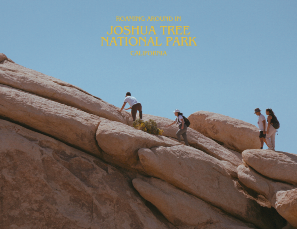
10-DAY CALIFORNIA ROAD TRIP ITINERARY
CALIFORNIA, USA
The Golden State, where the sun always shines and the landscapes never cease to amaze. With the highest amount of National Parks in the country, there are no shortage of things to see and places to be.
Here is our 10-day road trip of California.
CALIFORNIA ROAD TRIP OVERVIEW
This 10-day trip will begin and end in San Francisco, giving you the opportunity to experience the diversity of Californian landscapes. For this trip, we would recommend booking an RV to optimize the amount of time spent exploring the parks.
Roam vast meadows, unwind at the spa, behold the grandest trees, observe raging waterfalls, cruise by the glamorous coast, and stroll through the beautiful Santa Monica Pier. It will include unbelievable sunrises, extraordinary sunsets, and summiting Yosemite’s most famous peak. This itinerary embodies some of the finest that California has to offer and the ultimate guide to experience it’s greatest natural wonders.
This guide is constructed for the budget traveler and consists of what to do each day, where to stay, a few money-saving tips, and information on reserving National Park permits.
ROAD TRIP ITINERARY
Day 1: Pacific Coast Highway
Day 2: Los Angeles
Day 3: Joshua Tree National Park
Day 4: Sequoia National Park
Day 5: King’s Canyon National Park
Day 6: Yosemite National Park
Day 7: Half Dome
Day 8: Valley Loop Trail
Day 9: Glacier Point & Wawona Tunnel View
Day 10: San Francisco
MAP OF THE ITINERARY
DAY 1 - PACIFIC COAST HIGHWAY TO LOS ANGELES
Fly into San Francisco International Airport (SFO) and pick up your rental car. This will be a long day so you will want to start as early as possible. Trust me.
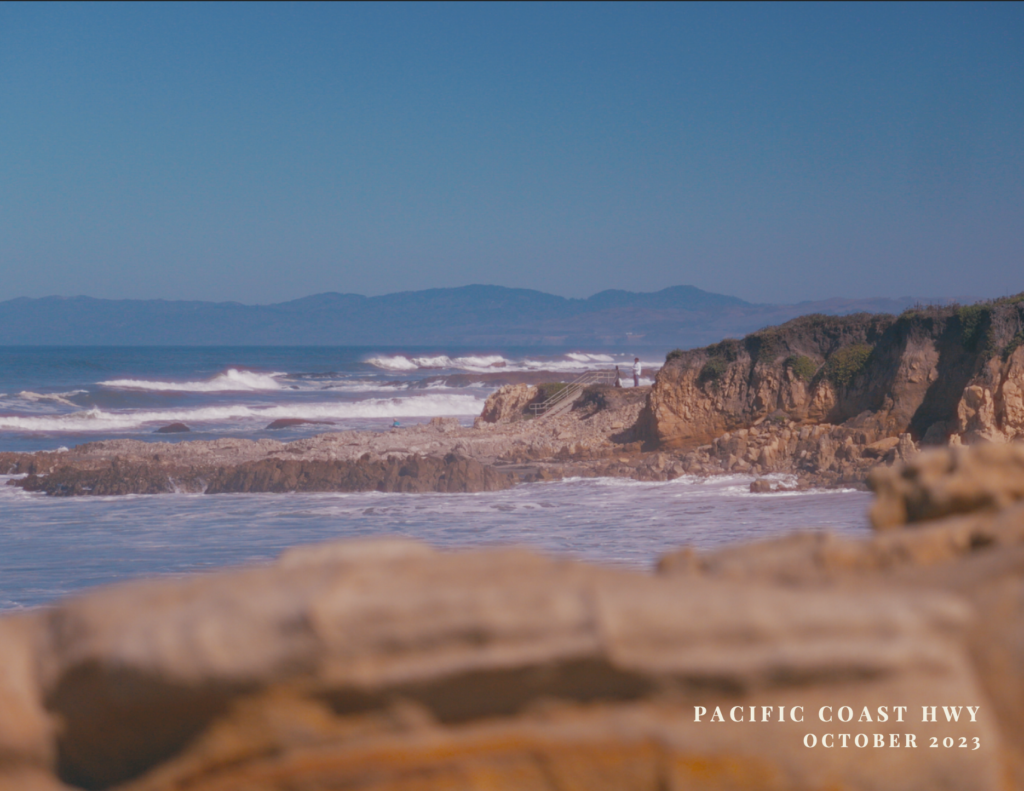
Head south on CA-1 towards Santa Cruz. On this route, you’ll get to admire the beautiful coastline.
STATE BEACHES
The California coast has countless beaches to marvel. You can stop at any one of these:
- Half Moon Bay
- San Gregorio State Beach
- Pomponio State Beach
- Pescadero State Beach
- Bean Hollow State Beach
- Gazos Creek State Beach

SANTA CRUZ
A vibrant town with rich cultural heritage and beautiful beaches. A good stop for lunch before you hit the road.
At this point, continue on the CA-1 until you reach Los Angeles. To cut down driving time, you can follow this route: CA-1 > CA-101S > CA-46E > I-5S. This will allow you to arrive at Los Angeles before the sun goes down, just in time for those who love catching sunsets.
LOS ANGELES
The driving time from San Francisco to Los Angeles via CA-1 to I-5 is about 7 hours and 8 minutes, which is why it is necessary to start as early as you can.
Santa Monica – highly recommend exploring the pier and grabbing dinner here before ending the night.
Wi Spa – a Korean spa that allows overnight stays for an additional fee. A good alternative to traditional accommodations for travellers on a tight budget. Lockers are provided, but only bring what you need because they are not that spacious.


Travel: 7 hours and 24 minutes (425 miles) | Stay: Wi Spa
DAY 2 - LOS ANGELES TO JOSHUA TREE NATIONAL PARK
Drop off your rental and pick up your RV. For this adventure, we went with Roadbear RV as they allowed one-way trips.
The driving time from Los Angeles to Joshua Tree National Park is about 3 hours and 45 minutes, so we recommend to leave just after lunch to watch the sunset over the valley.
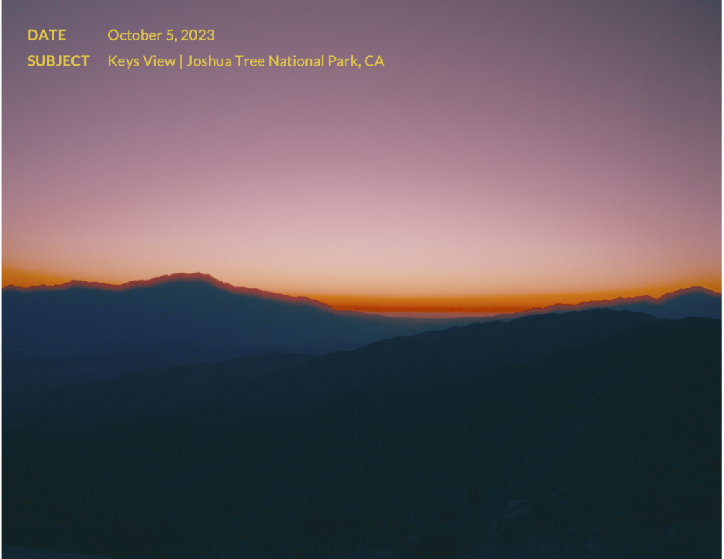
Sunsets – Keys View will be difficult to access with an RV although, it is an option if you get there early. Cholla Cactus Garden is a bit of a longer drive but nevertheless, another great option.
Stargazing – What makes Joshua Tree so unique is that any spot could be a stargazing spot, but it’s best when you are settled in, so we would recommend either Hidden Valley or Jumbo Rocks Campground.

Travel: 3 hours and 45 minutes (182 miles) | Stay: Jumbo Rocks Campground
DAY 3 - JOSHUA TREE NATIONAL PARK TO TEJON PASS
For sunrise, if you are staying overnight in the park, we highly recommend a viewing at Hidden Valley or Jumbo Rocks Campground. You will be able to catch stunning sunrises just less than 100 steps from your campsite. Other notable viewpoints would be Cholla Cactus Garden or Arch Rock.
EXPLORING THE PARK
After a delicious morning coffee and a tasty breakfast, you’re now ready for a hike and start exploring the uniqueness of Joshua Tree. Here are some great options:
- Skull Rock Trail – easy access from Jumbo Rocks Campground and a relatively easy trail featuring the Skull Rock (~37 min | 1.7 miles)
- Arch Rock Nature Trail – accessible from White Tank Campground, an easy out-and-back trail featuring the Arch Rock (~26 min | 1.2 miles)
- Barker Dam Nature Trail – a flat trail featuring a small lake reservoir (~30 min | 1.5 miles)
- Hall of Horrors Area – a short trail with “Slot Canyons” and large rocks that are available for climbing (~30 mins – 1 hour | 0.8 miles)


WHERE TO STAY
Take the I-5N via I-10W to I-210W towards Tejon Pass Rest Area, a free spot to rest if you are traveling by RV. Otherwise, you can travel a bit further north to stay in Bakersfield. It is a 3 and a half hour drive from Joshua Tree National Park, so you can’t leave the park too late.
Travel: 3 hours and 47 minutes (212 miles) | Stay: Tejon Pass Rest Area
DAY 4 - SEQUOIA NATIONAL PARK
This is where the trip starts to slow down and not feel as rushed. On day 4, drive from Tejon Pass (or Bakersfield if that’s your stay) to Sequoia National Park. Home to some of the largest trees in the world, these are some of the things to do.

GENERAL SHERMAN TREE
Residing within Sequoia National Park, the General Sherman Tree is the largest tree on Earth by volume and one of the defining attractions of the park. We would recommend going at around dawn or dusk for the best light. It is accessible by car from the General Sherman Tree car park (~15 min | 0.7 miles) or by hiking from Lodgepole Campground via the Lodgepole-Sherman Tree trail. (~1 hour and 10 min | 3.3 miles).
TOKOPAH FALLS
An easy hike through Tokopah Valley just east of Lodgepole Campground featuring a 1,200 foot waterfall, the tallest within Sequoia National Park. During the hike, you’ll encounter wildlife, cross luscious meadows, and take in staggering mountain views.
CONGRESS TRAIL
Beginning at the General Sherman Tree, this 2.7 mile loop gives you the opportunity to experience the sheer size of the Giant Sequoias. The Senate requires you to diverge from the Congress Trail a bit, but it is worth the short detour. This trail tends to get crowded, so we highly recommend to arrive as or just after the sun rises.


Travel: 3 hours and 19 minutes (159 miles) | Stay: Lodgepole Campground
DAY 5 - KING'S CANYON NATIONAL PARK
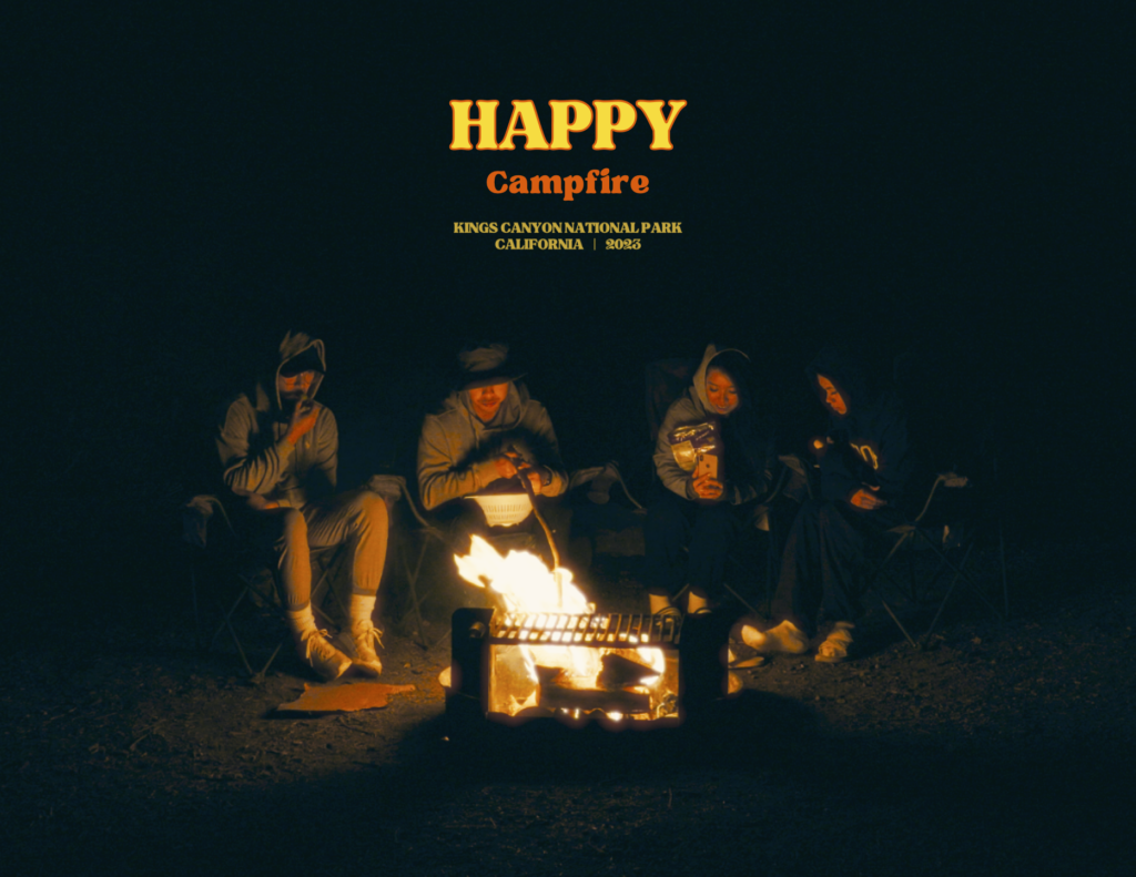
On this day, start the day off by catching the sunrise at Moro Rock. It is a granite rock formation situated between the Giant Forest and Crescent Meadow. It’ll be a short and tough 15 minute hike from the base of the rock. Arrive before dawn to enjoy a spectacular view overlooking the Sierra Nevada.


If you decide that another day in Sequoia is more worthwhile, Alta Peak is an excellent option for this day. However, we do recommend you save your legs and head over to Hume Lake in King’s Canyon as there is a more intense hike later on this trip.
HUME LAKE
An 87-acre lake on the outskirts of King’s Canyon with a few activities to do around this area:
- Sandy Cove – a beach and day use area with fantastic surrounding scenery.
- Tenmile Creek – a small creek flowing into the lake that is much more secluded.
- Water Activities – kayaks and paddle boards are available for rent at Hume Lake Christian Camps.
- Hume Lake Trail – an easy 2.8 mile loop around the lake that offers amazing views of the area.


GRANT GROVE
Go on an evening stroll to the Grant Grove. If you’re staying at Azalea (~15 min | 0.7 miles) or Crystal Springs Campground (~20 min | 1 mile), there are accessible trails right from the campgrounds that lead you to the Grove.
Along the route, you will greet:
- The Michigan Tree – a large fallen tree with the option to climb into the uprooted stump.
- The Fallen Monarch – a fallen tree that is hollow, allowing visitors to pass through.
- The Gamlin Cabin – a small cabin within the Grove built by the Gamlin brothers in 1872.
- The General Grant Tree – the largest giant sequoia in the Grove and the second largest in the world.


Travel: 1 hour and 17 minutes (40.9 miles) | Stay: Azalea Campground
DAY 6 - YOSEMITE NATIONAL PARK
Today, drive from King’s Canyon National Park to Yosemite National Park.
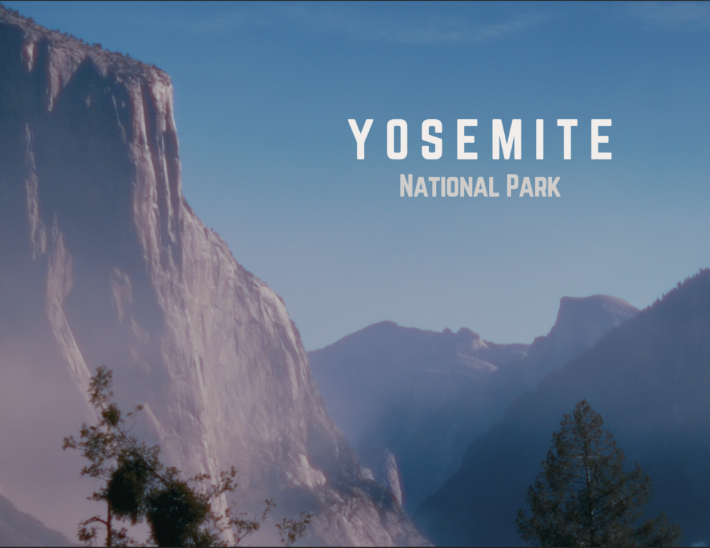
Yosemite is one of America’s most popular National Parks and in our opinion, the most beautiful of this itinerary. From it’s diverse terrain to the countless activities, there is no shortage of opportunities to explore California’s most wonderful park.
Leaving from King’s Canyon National Park, it will be a 3 hour and 20 minute drive to Yosemite Valley. Here is your chance to stop in Fresno for lunch or pass through and continue towards Yosemite Valley.
Expect to arrive by midday and be sure to stop at the Wawona Tunnel View for a magnificent sight of the valley.

YOSEMITE VALLEY
Known for it’s massive granite cliffs and thunderous waterfalls, there are several options once you arrive.
LOWER YOSEMITE FALLS
Located at the Northern part of the valley, Yosemite Falls is the highest waterfall in the park measuring in at 2,425 feet. Spend some time here to appreciate the might and power of this waterfall.
CURRY VILLAGE
A historic village situated near the end of the valley that offers a variety of activities to choose from including bike & raft rentals, free guided nature walks & historic tours of the village, and ice skating in the winter.
BRIDALVEIL FALLS
Found on the west side of the valley, Bridalveil Falls will be the first waterfall to appear as you enter the valley. The trailhead is accessible by car as you drive into the valley on Wawona Road, or by foot if you are coming in from the Valley Loop Trail. Standing at only 617 feet, it is still one of the most prominent waterfalls in Yosemite and flows year round.
MERCED RIVER
Flowing right through the middle of the valley, the Merced River is Yosemite’s main watercourse. For a more relaxing activity, unwind at any of these spots:
- Cathedral Beach
- Sentinel Beach
- Swinging Bridge Picnic Area
For our day 6 adventure, we channelled our inner Alex Honnold and free soloed a modest 5 meters up the southern face of El Capitan before walking over to El Capitan Meadow for an ethereal sunset in the valley.


WHERE TO STAY IN YOSEMITE
If you’re fortunate enough to snag a site, any campsites (specifically North, Upper & Lower Pines) within the valley would provide you incredible views of the surrounding cliffs and overall the best option.
If you are not so lucky, Wawona Campground is about 40 minutes south of the valley and the next best alternative for travellers on an RV road trip.
If you insist on lodging within the park, you can spend a little more and book accommodations at Curry Village or Yosemite Valley Lodge.
Travel: 4 hours and 8 minutes (173 miles) | Stay: Wawona Campground
DAY 7 - HALF DOME
This is it.
Day 7.
The day we summit the Half Dome. This was the defining moment of our entire trip, and honestly, the sole reason this trip even became reality. Quite frankly, everything before and after this day is just a bonus, because this is the ultimate goal of the itinerary. One thing to note, both physical and mental preparation is necessary to attempt this challenge as we’d consider this extremely risky and potentially life threatening.
Permits are required for the cables section of this hike, and can be obtained through a lottery system.
STARTING THE HIKE
The hike will be a 14 mile round trip (16 miles via John Muir Trail) for a total of about 10 – 12 hours, so you will want to begin as early as possible. We woke up at 4:30 am and started just after 5:00 am. Park at the Yosemite Valley Trailhead parking lot and commence the hike by heading to the John Muir Trail Trailhead.
MIST TRAIL
After the first mile (~36 min), you will reach the Mist Trail and John Muir Trail split. Sometimes the trail is closed for precautions, so if you are presented with the opportunity, take the Mist Trail and you will encounter:
- Vernal Falls – a powerful 317-foot waterfall with roars that echo through the canyon.
- Nevada Falls – a 594-foot waterfall at the base of the Liberty Cap, recognized for it’s “bent” shape.
Continue on this trail and you’ll merge onto the John Muir Trail at the top of Nevada Falls.


JOHN MUIR TRAIL
Taking the John Muir Trail will add an extra mile (one-way) to this journey, however, you’ll get a differing perspective of Vernal Falls and Nevada Falls. Proceed for 2.4 miles (~ 1 hour and 12 min) to the Half Dome Trailhead.
On the way to the Subdome, you will get your first glimpse of the Half Dome coupled with astonishing vistas of the Sierra Nevada.

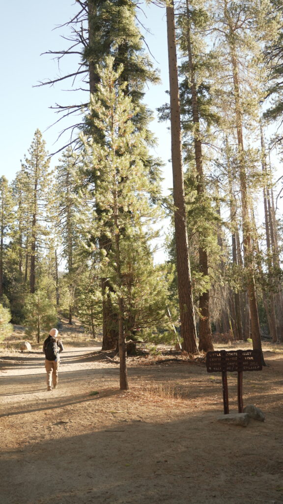

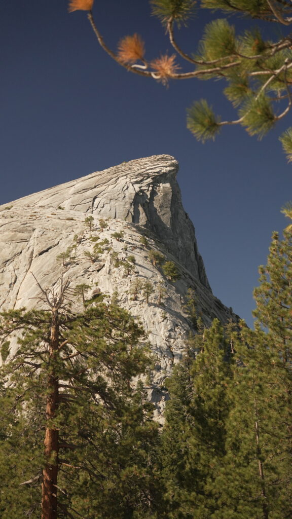
SUBDOME
This is arguably the toughest portion of the hike as it involves numerous slender switchbacks, gigantic granite stairs, and bafflingly immense inclines. A permit is mandatory in order to move past this point.
Here you will hike 0.3 miles and 460 feet to reach the Half Dome cables and the base of the Half Dome.
HALF DOME CABLES
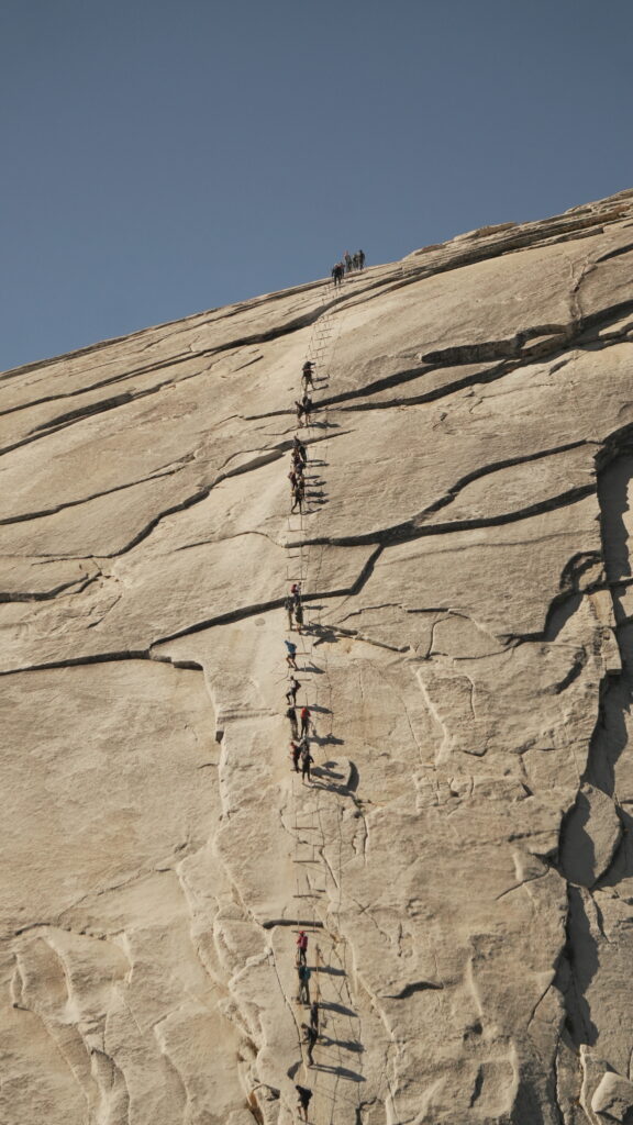
The last 400 feet from the summit and the most terrifying section are the Half Dome cables. At an angle of 45° and a slick granite surface, these cables are not for the faint of heart. Some crucial information prior to the 20 minute ascent:
- Gloves with good grip are necessary to prevent potential injury while holding the cables.
- Avoid overtaking as cables can get crowded and path is narrow.
- If you feel nervous or uncomfortable during the climb, turn around and head down.
- Gauge weather conditions. If there are signs of an incoming storm, do not attempt to summit.


HALF DOME
At the top of the dome, soak up the breathtaking sight of the Sierra Nevada stretching for thousands of miles.
A fun fact, the North Face logo was inspired by the shape of the Half Dome. It’s northwestern face appears to be flat making it seem like the dome was severed in half.
Now is the perfect time to claim a rock and refuel with some lunch or snacks while you are rewarded with 360° of panoramic views. Be sure to capture some shots overlooking the valley before making your descent.
Further details on our guide to hiking the Half Dome.


Travel: 50 minutes (26.2 miles) | Stay: Upper Pines Campground
DAY 8 - VALLEY LOOP TRAIL
For day 8, take the Valley Loop Trail to check off anything you haven’t seen in the valley from day 6. If you didn’t get a chance to see El Capitan yet, our suggestion would be to prioritize that.
We chose to spend our afternoon with a peaceful nap on some rocks at the bottom of the Yosemite Falls. With the remaining time, roam around in Leidig Meadow and then finish the day by completing the Valley Loop Trail.
If you have the budget, rent a bike and cycle across the valley to cover anything you may have missed.


Travel: 56 minutes (53.2 miles) | Stay: Wawona Campground
DAY 9 - GLACIER POINT & WAWONA TUNNEL VIEW
On day 9, kick off the morning with a ravishing sunrise at Glacier Point.
- If you’re coming from the within the valley, follow this route: Northside Drive > Southside Drive > Wawona Road South > Glacier Point Road
- For campers at Wawona Campground, your route would be: Wawona Road North > Glacier Point Road
GLACIER POINT
A brief walk from the parking lot to the amphitheater will give you a remarkable view of the rising sun in the distant horizon. On a clear day, you’ll have the privilege to witness a canvas of over a dozen peaks of the neighbouring mountains with the Half Dome as it’s centerpiece.

WAWONA TUNNEL
Once you’re satisfied with Glacier Point, make your way back to Yosemite Valley and stop at the Wawona Tunnel for the final time before you exit the park. The sunrise would have concluded by now, so just revel in the last moments here at Yosemite.

Say farewell to Yosemite and start the drive towards Westley Rest Area, another free spot to rest, by taking the CA-140W to the I-5. The total travel time is 2 hours and 56 mins (139 miles), so there is no rush to get anywhere. Along the route, there are the small towns of Mariposa and Merced which can be explored if you have an excess amount of time.
Travel: 3 hour and 52 minutes (169 miles) | Stay: Westley Rest Area
DAY 10 - SAN FRANCISCO
On the last day, start your drive early and drop off the RV. Depending on what time your return flight is, here are some last minute things to do in San Francisco:
- Visit the famous Golden Gate Bridge
- Check out the sea lions at PIER 39
- Snap some pictures at Lombard Street
Our flight was scheduled for mid-afternoon, so we concluded our 10-day long road trip with some Shake Shack at the Hillsdale Shopping Center in San Mateo.
Travel: 58 minutes (53.2 miles)
TRAVELING THROUGHOUT CALIFORNIA
CAR & RV RENTALS
We did the math and it was much more budget friendly to fly in and out of San Francisco than it was to fly into Los Angeles and out from San Francisco. It was also less expensive if we took the RV from Los Angeles to San Francisco than the other way around.
CAR RENTAL
Request for a hybrid vehicle if it is available to minimize the gas consumption on the drive down to Los Angeles. No need for anything fancy here, as the road is completely paved the whole way.
On this trip, we rented with Enterprise Car Rentals and our pick up was at San Francisco International Airport and drop off in Thousand Oaks, California.
RV RENTAL
There are a couple choices for one-way RV rentals: El Monte RV and Roadbear RV. A special license is not required to drive an RV, however, there are a few narrow roads on this trip you need to wary of.
- Generals Highway in Sequoia & King’s Canyon National Park
- Wawona Road south of Yosemite National Park
- Glacier Point Road

WHEN TO VISIT CALIFORNIAN NATIONAL PARKS
The Californian National Parks all have it’s own beauty during every season and there is always something to see. However, the best time to visit would either be mid-Spring (April to May), when the flow of Yosemite Falls is at it’s peak or late-Fall (September to October), when the foliage is at the height of it’s transformation.
During winter, many roads become too dangerous due to snow and ice, making them inaccessible. In contrast, the summer months come with extreme heat and bugs. Yosemite also requires reservations to drive into between July 1 through August 16 from 5 am to 4 pm every day.
PASSES & PERMITS
AMERICA THE BEAUTIFUL PASS
Over the course of this trip, you will pass 3 National Parks, each with an entrance fee of $30 – $35. In this case, purchase the America the Beautiful pass to save some money. This pass will grant you and up to 3 passengers, access to any of the National Parks across the US and is valid for one year.
The pass is available for purchase at any of the National Park entrances or online.
HALF DOME
If you are visiting Yosemite in the Spring or the Fall, a reservation is only required during the weekends. In the summer, a reservation is required every day.
In addition, you need a permit to summit the Half Dome. There is a preseason lottery and a two day-before lottery. Apply for a Half Dome permit here.
ALTERNATIVES OF THIS TRIP
There are some alternatives that can be made to save time or experience something different.
- If you don’t care for the coastal drive along the Pacific Coast Highway, consider flying into Los Angeles International Airport and spend the day exploring the city.
- If you enjoy the tranquility of Sequoia, swap one of the nights in Yosemite for another night in Sequoia.
- If you are unsuccessful in obtaining a permit for Half Dome, some great alternative hikes include Cloud’s Rest, North Dome, Upper Yosemite Falls
- If you have extra time, add a day in San Francisco to experience what the city has to offer.
Thanks For Reading!
Our content is free and we want to give readers as much information as possible before you travel. To support us, we have postcards from this trip that are available for purchase here.
